Balochistan : Map by Map
Map 1: 1724

It was made by the famous French cartographer Guillaume Delisle in 1724. Unified Balochistan (Mecran) can be seen within yellow boundaries. The map reads in French, ‘habite par les Baluches nation féroce et guerrière'(inhabited by the Baluches, a ferocious and warlike nation). Immanuel Kant was born in the same year, and Pakistan’s national language, Urdu, was still developing and known as ‘Moorish jargon’ among western foreigners.
Reference:
Author: L’Isle, Guillaume de, 1675-1726
Publication Date: 1724
Short Title: Carte de Perse.
Publisher: Guillaume De L’Isle, Quai de l’Horloge Publisher
Location: Paris
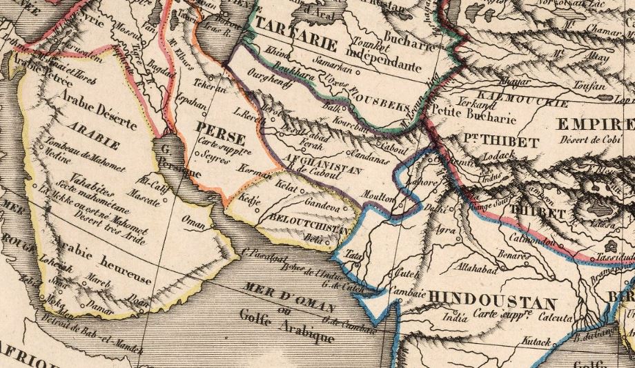
Map 2: 1829
The map shows a unified Balochistan and includes Sindh as part of Balochistan because Sindh has a large Baloch population and was ruled by a Baloch dynasty, the Talpurs, from 1783 to 1843 (until British colonisation).
Reference:
Author: Weiland, C. F. (Carl Ferdinand), 1782-1847
Publication Date: 1829
Short Title: Iran, Afghanistan und Beludschistan
Publisher: Verlag des Geographischen Instituts
Location: Weimar
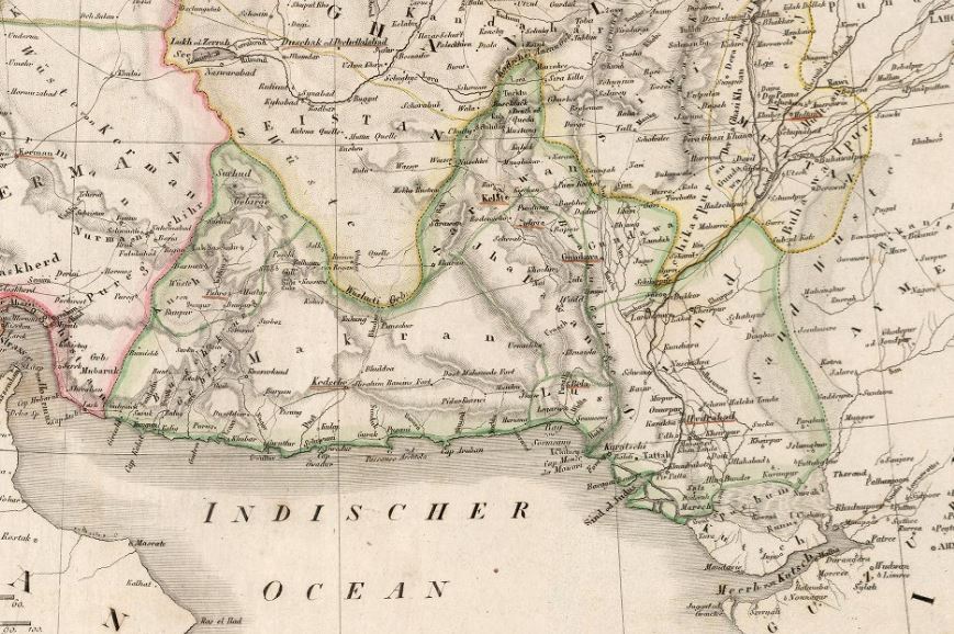
Map 3: 1839
Made by the French cartographer Augustin Legrand and published in 1839, the same year when the British Army stormed Balochistan’s capital Kalat (also known as Kelat/Khelat) and the founder of the Sikh Empire, Ranjit Singh, died.
Reference:
Author: Legrand, Augustin
Publication Date: 1839
Short Title: Exposition geographique XIII Tableau : Comprenant L’Asie et l’Afrique
Publisher: Bulla
Location: Paris
Map 4: 1876
This map was published by Japan for school curriculums in 1876. Japan was undergoing a transformation from a feudal society into an industrialised nation under Emperor Meiji. The western part of Balochistan was illegally given to Persia in 1871 by the British Empire, but the map still shows a unified Balochistan. (Light purple coloured country is Balochistan)
Reference:
Author: 三宅秀一編 [Shūichi MIYAKE].
Publication Date: 1876
Short Title:萬國地誌畧暗射掲圖 / 亜細亜之部 [Topographical Record of the Nations / Asia].
Publisher: Morimoto Tasuke
Location: Osaka
Map 5: 1884
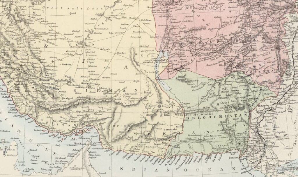
Published in 1884 in Edinburgh, the western part of Balochistan is shown as part of Persia after the Goldsmid line was imposed on Balochistan in 1871 by the British Empire. The maps show the historical town with Balochi names that were later Persianised by the Persian colonisers.
Reference:
Author: Black, Adam; Black, Charles
Publication Date: 1884
Short Title: Adam & Charles Black
Publisher: Morimoto Tasuke
Location: Edinburgh
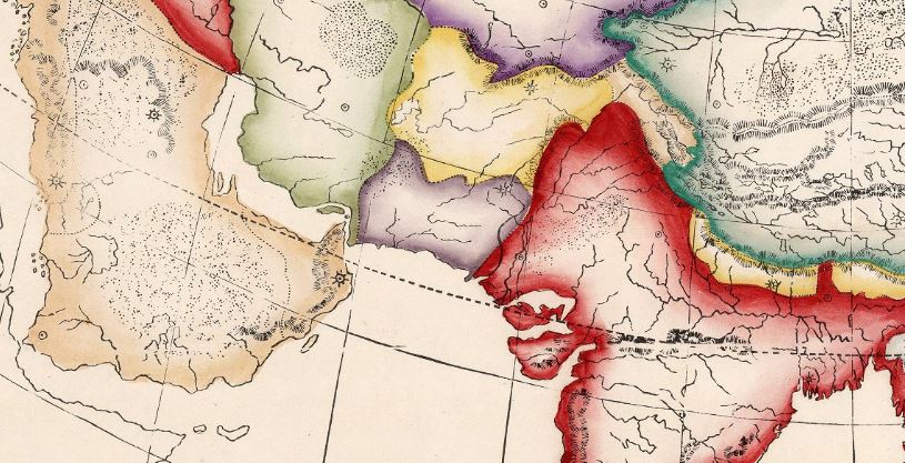
Map 6: 1900
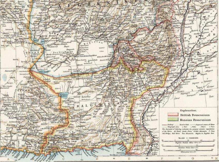
Published in 1900 from London, the Durand Line was imposed on Afghan and Baloch people in 1893. Afghanistan’s territory was merged into British India and British Baluchistan, while Balochistan’s northern lands were given to Afghanistan.
Reference:
Author: Andree, Richard; Times (London, England)
Publication Date: 1900
Short Title: Afghanistan and Baluchistan
Publisher: The Office of The Times
Location: London
Map 7: 1948
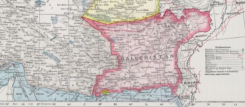
The last map of Balochistan as an independent and sovereign state was published in 1948. Newly created Pakistan still did not appear on the map. Once a unified country, Balochistan was divided and merged into three areas (British Baluchistan, Afghanistan, and Iran) by the British Empire, and then the eastern part also known as Kalat State was invaded by Pakistan.
Reference:
Author: Hammond, C.S.
Publication Date: 1948
Short Title: Japan and Korea. Iran (Persia), Afghanistan, and Baluchistan.
Publisher: Garden City Publishing Company, Inc.
Location: Garden City, New York
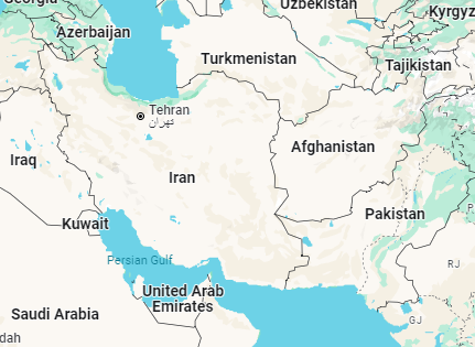
Map 8: Current map of the region
Balochistan gradually disappeared from the World Map as a sovereign state.